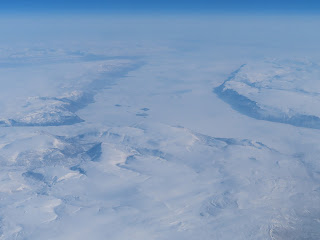
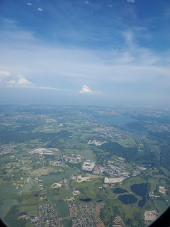
We flew SAS from Tokyo directly to Copenhagen. It was a 14 hour flight which makes it our third longest flight to date. The flight path took us over the Aleutian Islands just west of Anchorage Alaska. We saw the sea ice at the northern top of the planet. Then we continued over the ice cap and over the North pole. The flight crew made a very long announcement about the history of this flight path. SAS was the first airline to blaze this trail and they were proud of that. We then passed over the north eastern part of Greenland, over Norway and into Copenhagen. The ice sheet over Greenland was amazing thing to behold. So much to see. Had this been a night flight we would have missed everything.
A funny paintjob on a plane seen from the very busy lounge
On the runway looking over to the Tokyo Skyline
Big bridge over Tokyo bay
there is no mistaking the Skytree
Goodbye Japan
Super city!
So many waterways
Leading into the heart of Tokyo
We have reached our cruising altitude
Cotton ball clouds
We are already three hours into the flight
Open water sea ice
This is the ice cap
Not solid at this point
But too icy to swim in!
We have crossed the international date line and approaching the northern coast of Alaska
Lots of rivers feeding into the sea
I wonder if the fresh water is freezing upon contact with the cold ocean?
Very rugged land
Snow filled valleys and frozen rivers
Leaving land for a while
A very interesting difference in the colors of the clouds
These look like clouds it could be ice. Regardless there is ice below the clouds
On our way to the north pole
The belly camera on the plane has a cool rainbow like lens flare
The dotted lines changed from going to the left to going to the right once we passed the north pole
Ice cap time
Mostly solid ice with a few cracks
The ice sheet is in constant motion
Wind and currents push the ice
It often fractures and sheets can ride up on top of each other
There are also islands up here, part of Canada
Canada's North west Territory, flying almost due north
We passed over the north pole and have turned south again over the eastern part of Greenland
It is a huge ice sheet on top of this island
The largest island in the world that is not a continent
The ice here can be as thick as 1.9 miles
7% of the worlds entire supply of fresh water is atop Greenland
It is such a treat to see this
Not your everyday occurrence
Greenland!
To orient the viewer to our location
More details appear off int he distance
Very deep fjord
Pretty wide too
The question remains to be answered
Arte these frozen fjords or glaciers?
The blue really showed up in contrast to all the white
This is probable a series of glaciers
Bring your mittens
I guess is that this is a fjord
To be able to see how steep these cliffs are from up in a plane makes you realize how large the scale is of this area
This looks like a fjord, a bit frozen now
But this graphic would make one think that maybe these fjords open up in the summer
Back over the center of Greenland
Approaching Norway
Lots of lakes
Fjord Land
Denmark
Green farmland
More houses
Approaching Copenhagen
Our place is close to the center of this picture
Lots of city to explore
It has been 1 year and 363 days since we began pour Migration


